Walking
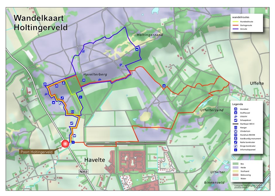
Havelterberg
Dolmen route (2.2 km, red arrows). This short route will take you to two dolmens, passing a vantage platform along the way. Along the route you will also find bomb craters, burial mounds and the geological monument.
- Ice route (5 km, blue arrows). This route crosses landscapes that originate from the ice ages.
- War route (3 km, green arrows). The Second World War has drastically changed the landscape of the Holtingerveld. The route will take you past hangars, bomb craters, the airstrip of the Grote Startbaan (runway) and various other taxiways.
Uffelter Binnenveld
Owner “Stichting Het Drentse Landschap” has laid out a walking route of about 3 km. You will reach the starting point of this walk from Havelte by turning left on the Uffelter Kerkweg onto the Markegenotenweg. The Uffelter Kerkweg is also the route to follow if you approach from the direction of Uffelte. Keep left when the road makes a bend to the right and is renamed into the Nieuwe Ruiterweg. After 30 metres turn left, onto the Markegenotenweg. The starting point of the walking route is situated along this road, at the wooden entrance gate on the left side. Because of the sheep, this route is not open for dogs.
Kolonieveen
- Natuurmonumenten has laid out a route towards Kolonieveen. The route starts at the old sheepfold at the Studentenkampweg North of Uffelte.
- There are also plenty of other opportunities to walk in other parts of the area. The map shows all the starting points. The area can be pretty wet in wintertime. We advise putting on some sturdy walking shoes.
There are several walking routes starting at the parking area along the road behind the es (historic type of elevated agricultural land) in Uffelte, such as the Experience Route. Follow the peat canal.